Description
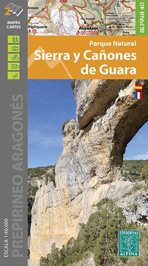
•Two hiking maps
•Scale 1:25.000
•Equidistance contours: 10 m distance
•Master contours: at 50 m
•Shady relief
•Compatible with GPS
•Marked routes
•Land use symbolized at three levels
•Scale 1:25.000
•Equidistance contours: 10 m distance
•Master contours: at 50 m
•Shady relief
•Compatible with GPS
•Marked routes
•Land use symbolized at three levels
| Verlag: | Editorial Alpina |
|---|---|
| Reihe: | Editorial Alpina 1:40.000 |
| Maßstab: | 1:40.000 |
| Medienart: | Karten |
| Sprache: | Französisch, Spanisch |
| EAN: | 9788480909280 |
| Höhe in mm: | 200 |
| Breite in mm: | 110 |
| Erscheinungsjahr: | 2022 |
| Kontinent: | Europa |
| Land: | Spanien |
| Bundesland / Provinz: | Aragón |
| Region: | Sierra de Guara, Aragonesische Vorpyrenäen |
| Orte / Berge / Seen: | Huesca, Arguis, Alquézar, Arcusa, Coscullano |


Reviews
There are no reviews yet.